Custom maps
CartoGIS produce high quality maps to support education, outreach and research activities.
Our maps are customised to your needs and are suitable for use in your lectures, research publications, books, theses and presentations. Maps highlight a range of themes such as historical empires, ethnicity, election results, transport systems, military placements, historic battles, disputed borders, archaeological sites, and more. GIS is used to accurately locate data and perform spatial analysis.
Below you will find examples of the variety of maps we produce. Base maps made by CartoGIS Services can be downloaded via Maps Online.
Custom maps are available to all ANU academic staff, professional staff, and PhD students. Contact us to discuss your specific map needs, or request work via our request form.
Example maps
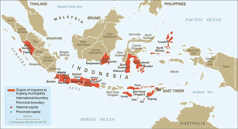
Migration to Kupang, Indonesia
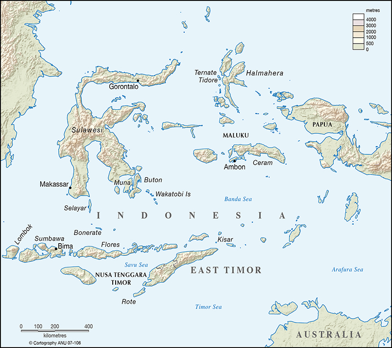
Map of east Indonesia
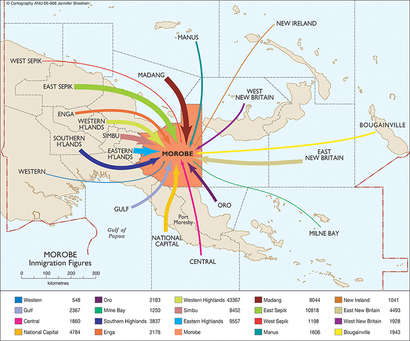
Immigration to Morobe, PNG
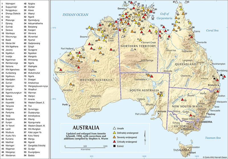
Map of Australia
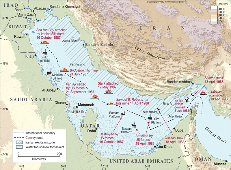
Military map with elevation
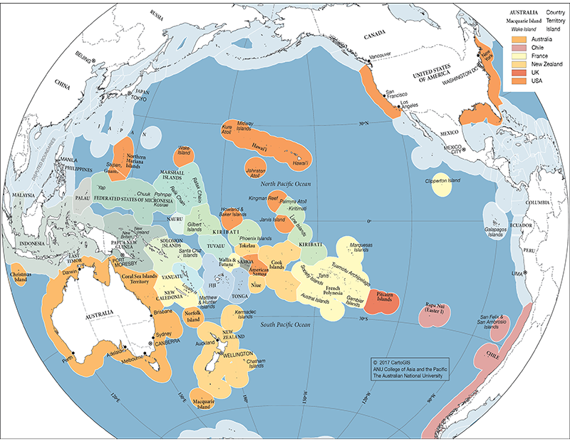
Pacific EEZ
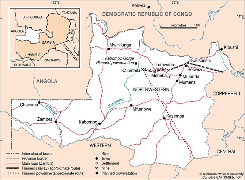
Zambia
Contact
- CartoGIS+61 2 612 52230